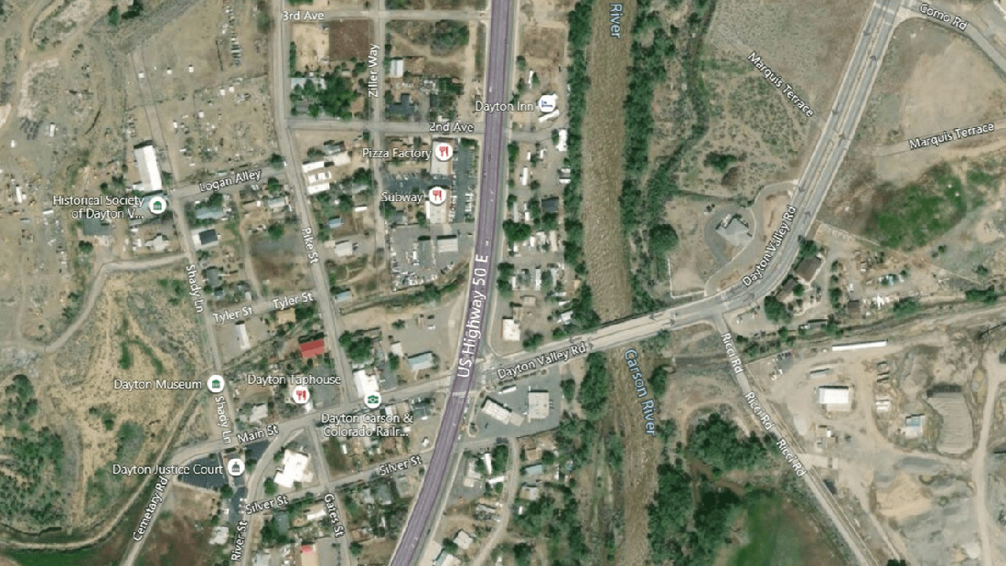
A story submitted yesterday by a reader of Carson Now describes the migration down Main Street and across the Carson River Bridge. The article does not give their destination or what other animals they might encounter at the end of the journey.
Perhaps they were coming off an allotment on the north side of Highway 50, heading for another on the south side. Just a guess. The highway generally runs east-west despite the north-south jog in the following image.
The Operator Information report in RAS shows four authorizations associated with Borda Land and Sheep, 2700069, 2700348, 2702960 and 2703505.
The Allotment Information report ties those authorizations to the Bagley Valley, Buckeye, Carson Plains and Pine Nut allotments.
The Authorization Use report for Carson Plains shows the last grazing season ending today, May 31 and another, on the Pine Nut allotment, starting tomorrow, June 1.
Borda holds all of the active AUMs in Pine Nut. So maybe they were migrating from Carson Plains to Pine Nut.
The Pine Nut Mountains HMA is also on the south side of the highway. Although grazing allotments and wild horse areas sometimes have similar names, Western Horse Watchers does not know if the two overlap. Would you be surprised if they did?
The Allotment Master report shows Pine Nut in the Improve category.
The Virginia Range, on the north side of 50, includes some BLM land.
UPDATE: Table 1 in a 2018 EA for wild horse management actions shows nine allotments intersecting the HMA but Pine Nut is not one of them.