Butte Vally Ranch covers nearly 900,000 acres, including 7,300 deeded acres, in four counties between Wells and Ely, NV, according to the agent’s description.
The owner runs 700 head of cattle and 5,000 head of sheep on public lands offering 20,641 AUMs per year.
There are 570 acres under pivot with approximately 2,000 acres of riparian meadow.
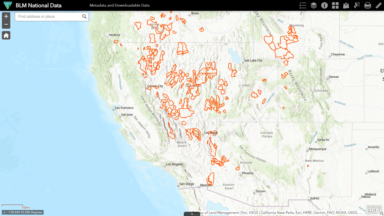
The map on page 7 of the brochure shows private lands in red and public lands in purple.
The purple outline suggests the new owner will have grazing preference on 14 BLM allotments, identified with the National Data Viewer.
These parcels are managed by three BLM field offices, necessitating three Allotment Master Reports (Wells | Bristlecone | Basin & Range).
The ranch does not hold all of the active AUMs, indicated by “N” in the All AUMs column of the following table.
It may operate as Butte Valley Land & Livestock on some allotments and Mountain Air Cattle Company on others, but this is not explained in the listing. Mountain Air could be an affiliate or lessee.
West Cherry Creek is in the Wells Field Office. The next seven are in Bristlecone and the last six are in Basin & Range (National Monument).
The total acreage falls short of the amount indicated in the listing.

The allotments are mediocre in terms of forage availability, offering a weighted average 35.5 AUMs per year per thousand public acres, enough to support three wild horses per thousand public acres.
Still, the BLM insists that public lands in the western U.S. can only sustain one wild horse per thousand acres (27,000 animals on 27 million acres).
A little more than half of the public acreage is in the Improve category.
The condition of the Custodial acreage is not known.
As the new owner, you could accept the status quo and compete with wild horses, indicated by the last column in the table, or you could develop a rewilding plan and petition the BLM for a change in livestock types and seasons of use, as American Prairie did for bison in Montana.
This is the concept of leverage. A few thousand private acres control hundreds of thousands of public acres. The ranchers have been doing this for years.
Would the rewilders, such as the CANA Foundation, actually try this?
Don’t hold your breath.
The base property, located inside the northern allotments, is connected to the southern allotments by the trails.
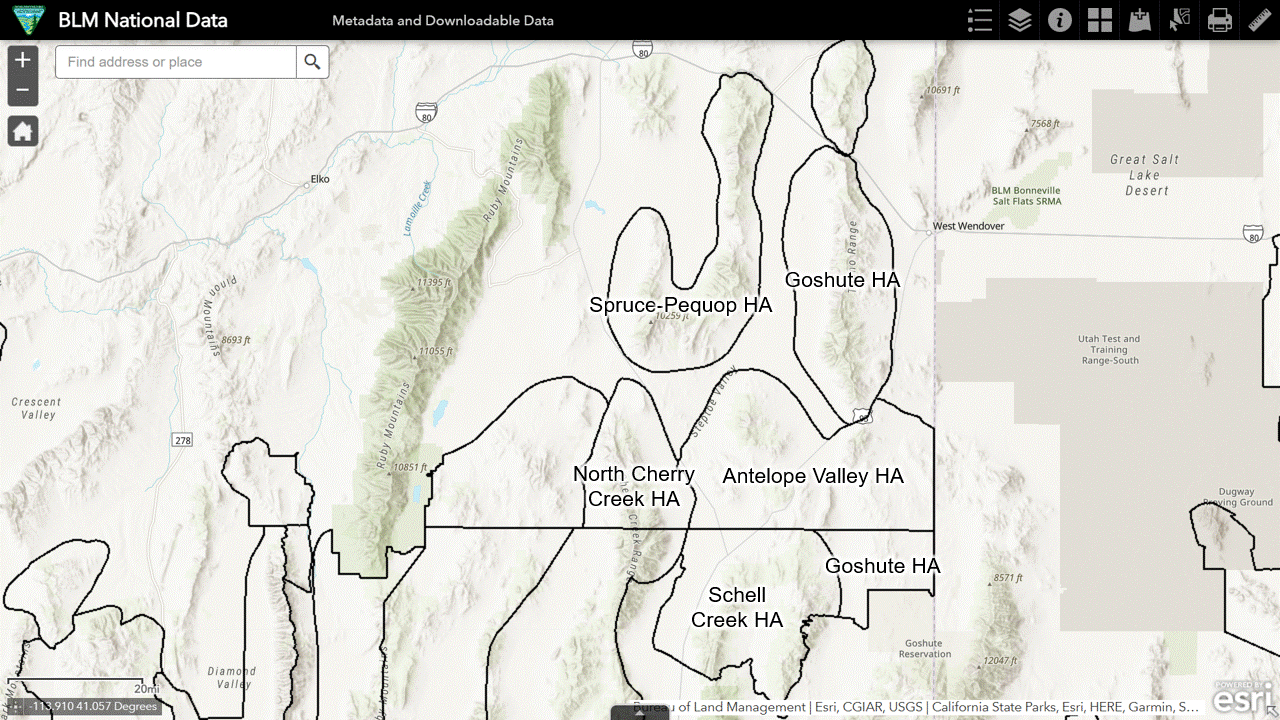
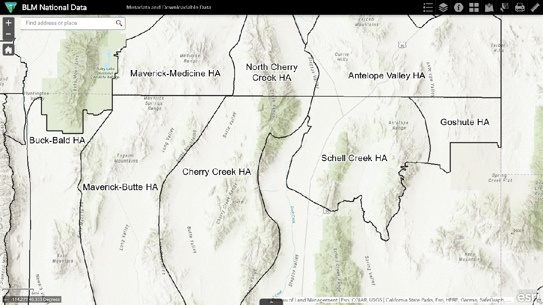
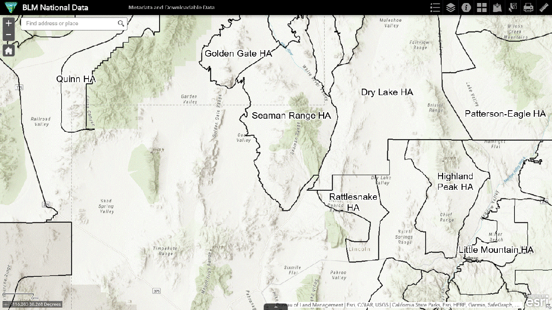
The National Data Viewer shows the allotments relative to the HAs and HMAs.
The northern allotments lie within the Maverick-Medicine and Triple B HMAs, frequent targets of motorized removals. Now you know why.
Jakes Unit Trail, not shown in the map, begins at the southern edge of Medicine Butte and runs south, transitioning to the Preston Lund Trail.
Preston Lund continues southward, joining up with the White River Trail, which connects to Dry Farm and Needles.
Dry Farm and Needles overlap the Golden Gate and Seaman Range HAs, areas unfit for wild horses but not for privately owned livestock.
Access to the other four allotments is unknown. Click on images to open in new tabs.
The asking price does not include the current inventory of cattle and sheep.
From a resource viewpoint, those animals are equivalent to 1,700 wild horses, about three percent of those in off-range holding.