Open the viewer, dismiss the splash screen and zoom/drag the map to the area you want to investigate.
In this example, the map has been scrolled to southwest Wyoming, the area affected by the Rock Springs RMP Amendments.
Click the layers icon to display the layer list.
Clear all of the check boxes except Wild Horse and Burro.
Expand the WHB layer by clicking the little triangle on the left.
By default, only HAs are displayed (black borders).
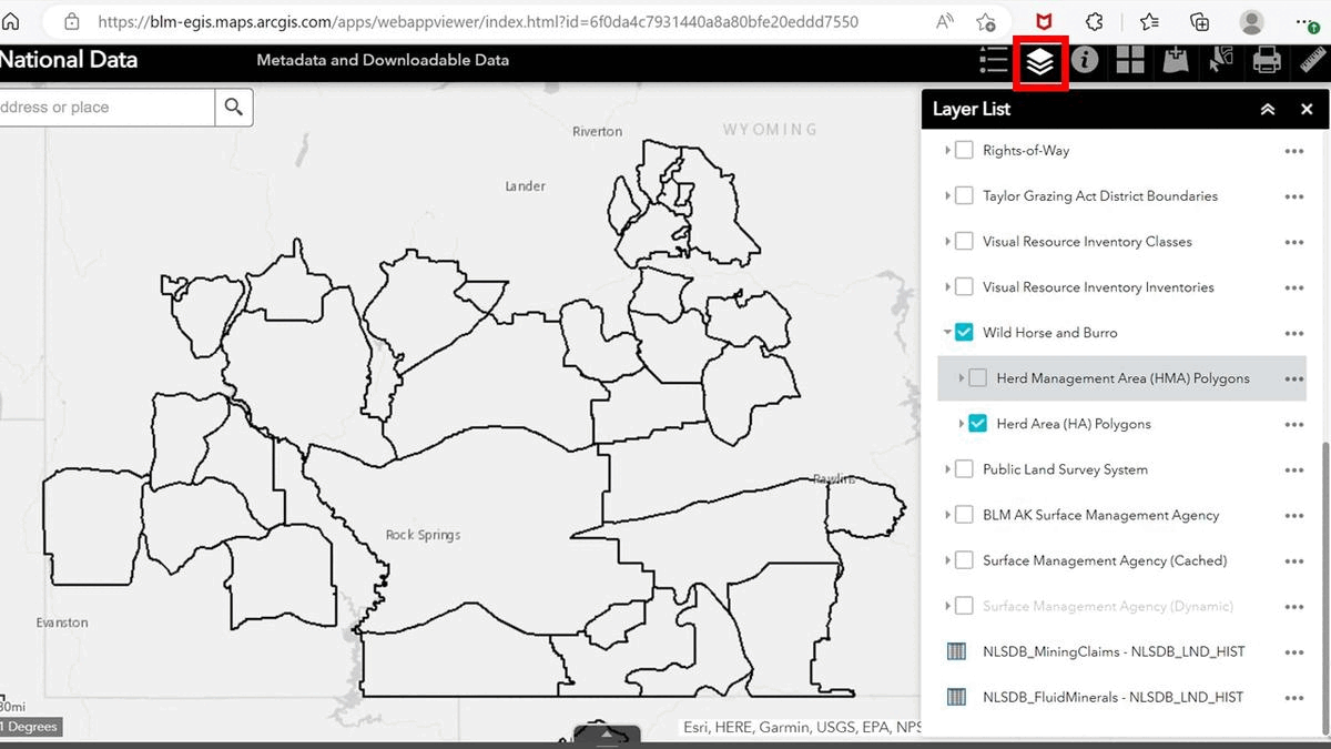
If you put a check in the HMA box, the map will show the HMAs (orange borders).
Clear the HA check box if you only want to view the HMAs.
If you click on one of the polygons, a pop-up box will provide data for that area.
As noted yesterday, the black parcels denote land identified for wild horses and burros, while the orange areas represent those where horses and burros are still allowed—in small numbers, of course, relative to the available resources.
Scroll the list up and turn on the grazing allotments (green borders).
Now you know why there are 62,000 wild horses and burros in off-range holding.
The map tells you by visual inspection that roughly half of the land in this part of the state designated for horses and burros has been lost to permitted grazing, while the remainder has been subordinated to permitted grazing.
Has your favorite advocacy group explained any of this to you?
RELATED: Exploring the BLM National Data Viewer.
