A downside of the Western Watersheds map is that it does not show the HAs, only the HMAs, but the National Data Viewer shows both, along with grazing allotments.
In this example, allotment boundaries are green, HMA boundaries are orange and HA boundaries are black.
If you click inside one of the polygons, a pop-up box takes you through the applicable land designations by hitting the little triangle in the upper right.
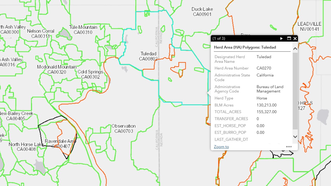
Turns out that Campito’s old stomping ground, the Buckhorn HMA, and the adjacent Coppersmith HMA, are inside the Tuledad HA.
The HAs show you how much land was originally identified for wild horses and burros and the HMAs show you how much remains.
The New Ravendale horses have lost roughly half of their land, denoted by the orange parcel inside the black parcel that’s overlapped by the Ravendale AMP Allotment.
