The story by FOX10 News in Phoenix indicated that the dead animals were found near Forest Road 25 in the Alpine and Springerville Ranger Districts.
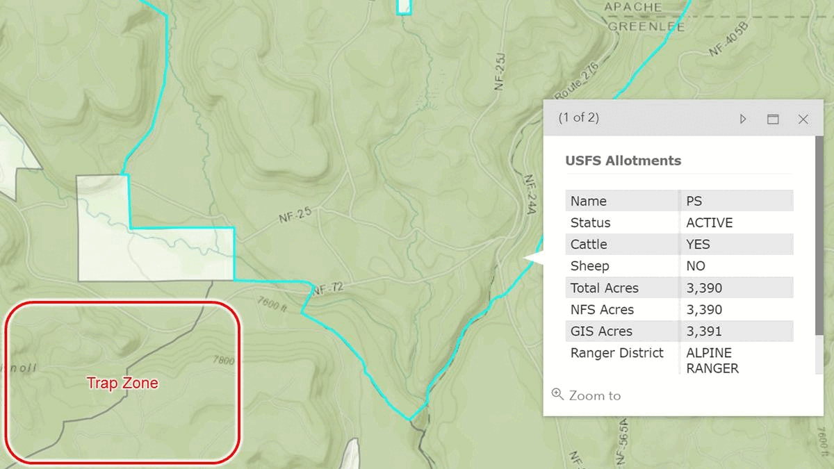
The Western Watersheds map shows Road #25 in the PS Allotment, about 15 miles southwest of Alpine and near the area where the Jumping Mouse horses were trapped earlier this year.
The area is not just known for its grazing potential, but is home to some of the best elk and mule deer habitat in Arizona.
The Annual Operating Instructions for PS indicate two pastures, with grazing seasons ending in just a few days.
