The map supplied with the listing shows the ranch with a red border.
Deeded acreage, which secures grazing preference on public lands, is black.

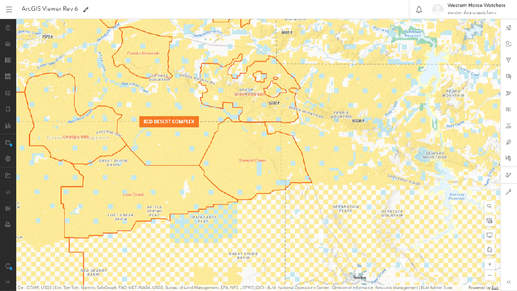
If you plot the ranch outline on a map of the HMAs, you’ll find it overlaps all of Crooks Mountain and Stewart Creek, and most of Green Mountain.
A small portion extends into the checkerboard near Rawlins.
Click on image to enlarge.
RELATED: Wyoming’s Pathfinder Ranches Changing Hands.