The move follows the nomination of outgoing president Kathleen Sgamma as director of the BLM according to a news release dated April 2.
RELATED: Trump Nominates Sgamma to Lead BLM.
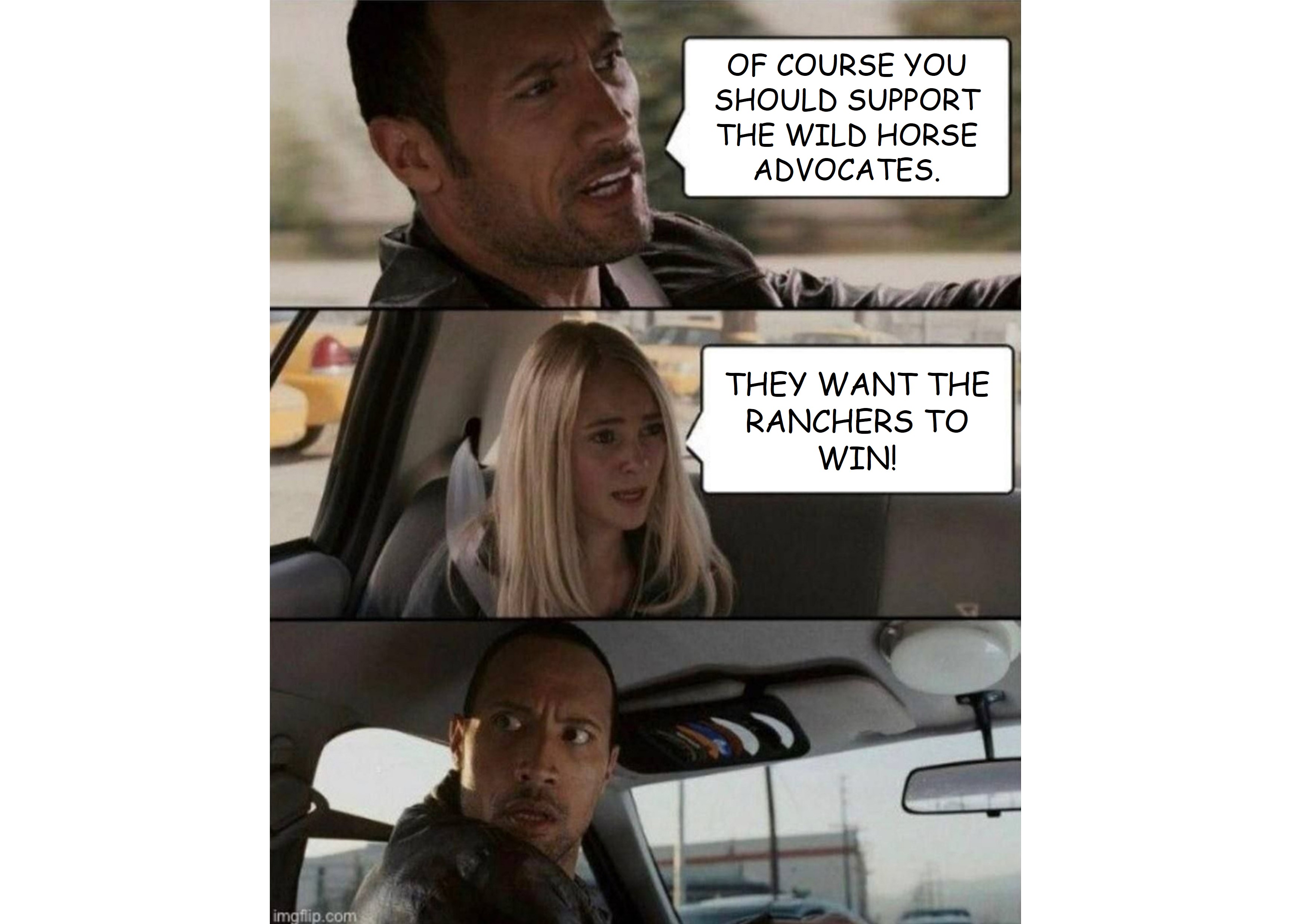
Western Horse Watchers Association
Exposing the Hypocrisy, Lies and Incompetence of the Wild Horse Advocates
The move follows the nomination of outgoing president Kathleen Sgamma as director of the BLM according to a news release dated April 2.
RELATED: Trump Nominates Sgamma to Lead BLM.
AMLs are often expressed as a range, such as 120 – 200.
In this example, horse #121 is excess, the beginning of overpopulation according to current management practices.
The high end of the range usually corresponds to around 20% of the authorized forage.
The management plan allows 200 wild horses and livestock equivalent to 800 horses.
If the current population is less than 5X AML, the HMA is not overpopulated from a resource viewpoint, but the ranchers won’t be able to access all of the AUMs on their permits until corrective actions are taken.
The AML range usually allows for a doubling of herd size between those actions.
A narrow range means little if any growth.
The new AML at Pryor Mountain, 107 – 120, implies heavy use of fertility control pesticides and sterilization of mares, synonymous with conservation in advocacy circles.
RELATED: BLM Releases Pryor Mountain Final Planning Documents.
Approximately 1,600 adopters who had received title when the March 3 decision was issued but had not received the incentive are eligible for payment according to a story by Colorado Politics.
The judge said in an April 1 order that the ruling does not restrict the agency from fulfilling preexisting contractual obligations.
RELATED: Court Halts AIP.
There is much distress among the advocates at the prospects of losing 3,700 wild horses in three HMAs in Wyoming, yet there is nary a concern about the fate of wild horses at the Salt River and Virginia Range.
There, the advocates are wiping out herds of approximately 300 and 3,400, respectively, by sterilizing the mares.
Why is the former considered eradication while the latter passes for conservation?
RELATED: Foal-Free Friday, Cycle of Dependency Edition.
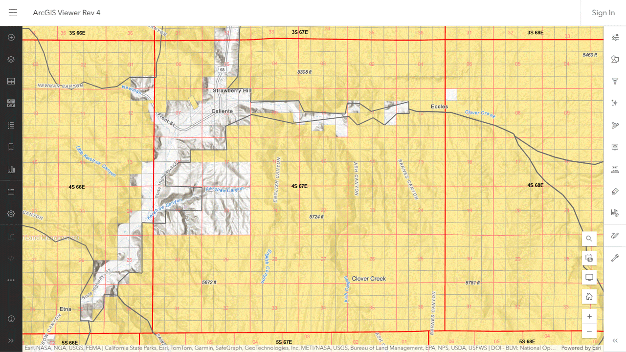
The project covers the sale of approximately 5,500 acres in 66 parcels according to the BLM news release.
Some are the Caliente Complex.
The scoping report includes eight maps showing their locations.
To find them in the ArcGIS viewer, turn on the PLSS layer and zoom/drag the map to the township-range blocks indicated in the report.
To identify the overlapping herd areas and allotments, turn on those layers.
Map 1 of 8
Map 2 of 8
Map 3 of 8
Map 4 of 8
Map 5 of 8
Map 6 of 8
Map 7 of 8
Map 8 of 8
The following image shows the 640-acre parcel in map 2 of 8, east of Caliente NV.
The project description does not say how the land would be offered for sale or when.
Red Rock Lakes has been added to the Emergency/Nuisance section and Beaty Butte has been dropped from the post-foaling-season section.
The capture and removal goals in the April 1 edition are 10,789 and 10,281, respectively, compared to 11,189 and 10,681 in the March 3 edition.
The number of animals to be treated with fertility control was also trimmed slightly.
She currently serves as president of the Western Energy Alliance according to a report by AP News.
Western Horse Watchers was unable to find a statement opposing wild horses at the WEA public lands page.
You’ll have to go the American Farm Bureau Federation or Public Lands Council for that.
The advocates would have you believe that drilling and mining are the greatest threats to these animals, as permitted grazing devours entire HMAs and beyond.
As of today, the BLM org chart shows the director’s position as vacant.
RELATED: Shultz to Head Forest Service.
One of the objectives in the Land Management Plan for the Tonto National Forest is to evaluate at least one vacant allotment every two years to (1) convert it to forage reserves, (2) grant it to a current or new permittee or (3) close it to permitted grazing.
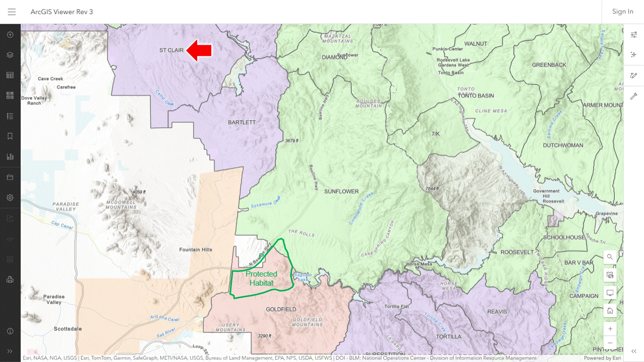
The 2018 report on forage availability states in Appendix 5 that the Goldfield, Bartlett, St. Clair and Sunflower allotments are most similar in vegetation, soil, and topography to the Salt River horse zone.
The ArcGIS viewer indicates that Bartlett and St. Clair are vacant.
Appendix 5 also indicates that the two allotments offered a combined 7,404 AUMs on 116,430 acres, equivalent to 617 wild horses, or 5.3 wild horses per thousand acres.
Your faithful public servants claim the rangelands in the western U.S. can only support one wild horse per thousand acres.
If the advocates had a base property that met Forest Service requirements, they could ask the agency to attach it to one or both of the allotments, securing grazing preference thereon.
The livestock type would be horses and the season of use would be 12 months.
This would probably require a NEPA review, which could span several years, complete with blowback from ranching interests.
But it would be better for the horses compared to their current situation, crammed into a 20,000-acre habitat with the number of viable mares decreasing every year.
RELATED: Leadership Needed at Salt River.
There were 65,062 wild horses and 3,081 wild burros in off-range holding according to the January update.
The 2025 population dataset indicated there were 53,797 wild horses and 19,333 wild burros on public lands as of March 1, compared to AMLs of 22,637 and 2,919.
RELATED: BLM Releases 2025 Wild Horse and Burro Population Dataset.
The band of seven will be captured and taken to Wildfire’s Wild and Free Mustangs after the foal gets a little older according to this report by FOX5 News of Las Vegas.
RELATED: Not Again! Child Kicked by Horse on Mount Charleston.
UPDATE: Original video superseded by this one.
And you thought PZP darting was the only job that could be done by trained monkeys.
