The project covers the sale of approximately 5,500 acres in 66 parcels according to the BLM news release.
Some are the Caliente Complex.
The scoping report includes eight maps showing their locations.
To find them in the ArcGIS viewer, turn on the PLSS layer and zoom/drag the map to the township-range blocks indicated in the report.
To identify the overlapping herd areas and allotments, turn on those layers.
Map 1 of 8
- No parcels in herd areas
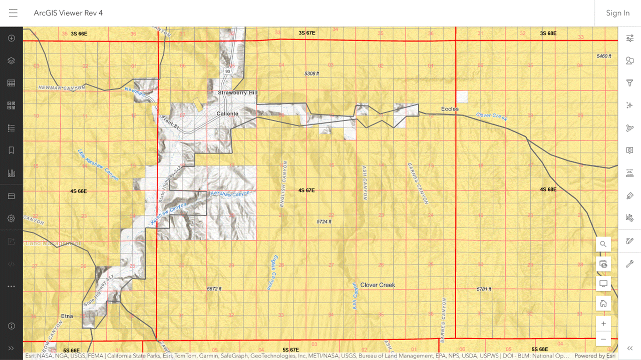
Map 2 of 8
- In Little Mountain HA
- Rnd 9, Caliente C, Sec 27, 40 acres
- Rnd 10, Caliente B, Sec 27, 40 acres
- Rnd 10, Caliente A, Sec 27, 40 acres
- Rnd 9, Caliente D, Sec 27, 40 acres
- In Clover Creek HA
- Rnd 6, Caliente A, Sec 08, 80 acres
- Rnd 6, Caliente B, Sec 17, 160 acres
- Rnd 5, Caliente A, Sec 14, 640 acres
Map 3 of 8
- No parcels in herd areas
Map 4 of 8
- No parcels in herd areas
Map 5 of 8
- In Fortification HA
- Rnd 10, Mount Wilson B, Sec 34, 20 acres
- Rnd 10, Mount Wilson A, Sec 34, 20 acres
- Rnd 5, Mount Wilson A, Sec 34, 40 acres
- Rnd 5, Mount Wilson B, Sec 34, 40 acres
Map 6 of 8
- In Little Mountain HA
- Rnd 5, Panaca A, Sec 16, 40 acres
- Rnd 5, Panaca B, Sec 16, 40 acres
- Rnd 5, Panaca C, Sec 20, 40 acres
- Rnd 6 Panaca A, Sec 19, 40 acres
Map 7 of 8
- No parcels in herd areas
Map 8 of 8
- No parcels in herd areas
The following image shows the 640-acre parcel in map 2 of 8, east of Caliente NV.
The project description does not say how the land would be offered for sale or when.