Practice with the PLSS (ArcGIS Viewer Update)

A listing on Zillow gives the address of a 40-acre parcel in Storey County as 40 SW 4nw4 S 16/18n/21e LOT 12S, Reno, NV 89521.

Listing on Zillow 40 Acre Lot 03-15-25

The map puts it on Sazarac Rd which is wrong.

The callouts for these properties should be read from right to left.

The first part tells you it’s in Section 16 of Township 18 North, Range 21 East.

The township-range blocks typically consist of 36 sections covering one square mile each.  The sections usually contain sixteen 40-acre parcels.

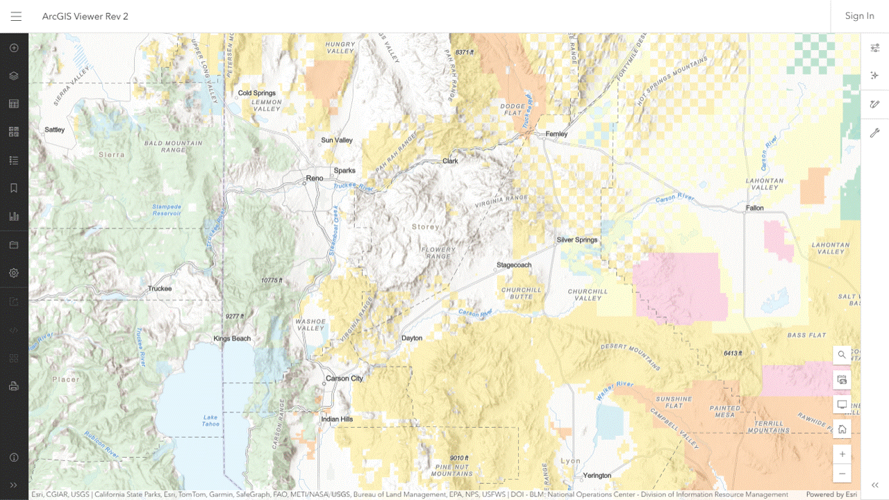
Zoom the viewer to the Reno area, turn on the Public Land Survey System layer and look for 18N 21E.

Listing on Zillow for 40 Acre Parcel A 03-15-25

Zoom in on that block and look for Section 16.

Listing on Zillow for 40 Acre Parcel B 03-15-25

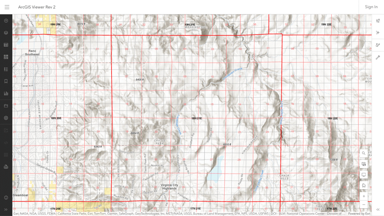
Zoom in on Section 16.

Listing on Zillow for 40 Acre Parcel C 03-15-25

The section can be divided into four quarters, each one containing four lots.

Lousetown Creek flows through it, probably from the southwest to northeast.

The listing tells you it’s the southwest lot in the northwest quarter.

Listing on Zillow for 40 Acre Parcel D 03-15-25

The photo tells you it’s on the Virginia Range.

These parcels, although very remote, are zoned as single-family residences.

Scoping Begins for Callaghan HMAP

A management evaluation has been copied to the project folder for public review.

The Complex consists of the Bald Mountain, Callaghan, South Shoshone and northern end of the Hickison HMAs, as well as the North Shoshone HA.

The HA has been zeroed out and will be omitted from the analysis.

The HMAs are subject to permitted grazing.

Comments will be accepted through April 14.

The HMAP will ratify and reinforce resource allocations already on the books.

If the Complex was managed primarily for livestock before the project, it will be managed primarily for livestock after the project.

Callaghan Complex with Allotments 03-14-25

BLM Issues CX for Red Rock Lakes Wild Horse Removal

NEPA analysis is not necessary according to the Decision Record.

In the latest incident, wild horses moved onto private lands, breaking through fences and eating hay stored in pole barns.

The project description says they’re leaving the HMA due to insufficient food and water.

The ArcGIS Viewer indicates it’s subject to permitted grazing.

The agency did not indicate if California is a fence-out state.

A roundup does not appear on the latest schedule but may fall into the “Unassigned” category of the Emergency/Nuisance section.

Red Rock Lakes HMA with Allotments 03-13-25

HB25-1283 Financial Impact Statement Released

The bill requires an appropriation of $555,000 in FY 2025-26 to help manage the state’s wild horse population according to the statement.

It allows the Department of Agriculture to start an immunocontraception program and creates a wild horse advisory committee.

Funding for a wild horse preserve was not discussed.

RELATED: Colorado Wild Horse Working Group Supports HB25-1283?

Mares Run the Show at Wild Horse Refuge?

It’s a nonreproducing herd, and the males are actually geldings, but an article by the Craig Press refers to them as stallions.

“While the stallions are the big flashy ones that do all the big bites and everything, it’s those older mares that are really the bosses, and nobody crosses the boss mare.”

That might be true at the refuge but it’s not true in the wild, despite all the fairy tales you’ve heard from the advocates.

Problem is, it’s getting harder and harder to find herds that are truly wild.

Many in the public eye, especially those chronicled on socialist media, have been decimated by the government or ruined by the advocates.

To its credit, the refuge is based on the right concept—purchasing a base property and flipping the preference to horses—but the numbers fall short of the ideals.

RELATED: How Does Wild Horse Refuge Rate as a Wild Horse Refuge?

Pancake HMAP Proves Advocates Ill-Informed About Wild Horses

Remember last April, at the Save Our Wild Horses Conference in Reno, when they were higher than a kite on HMAPs?

Now that the plans are rolling out, they’ve developed a bad case of amnesia.

Consider the Pancake HMAP, just released.  It’s discussed in Appendix XIII of the Final EA for management actions in the Complex.

  • Area will be managed for 336-638 wild horses
  • Gather and remove excess animals to reach low AML as soon as possible
  • Apply fertility control pesticides and/or IUDs to released mares
  • Maintain a sex ratio of 60% males and 40% females
  • Bring in mares from another HMA if genetic diversity declines

This must be good for the herd because it doesn’t include aerial shooting.

RELATED: Antelope-Triple B HMAP Proves Advocates Are Ill-Informed About Wild Horses.

Surface Management Agencies Along the Salt River

The river flows westward through a mountainous area in the Tonto National Forest until it reaches Saguaro Lake.

Along the way, it passes the Sunflower Allotment to the north and the Reavis, Tortilla, Superstition and Goldfield Allotments to the south.

Then it flows west southwest through Goldfield before crossing into BIA land.

The Saguaro WBT overlaps the southern portion of Sunflower but it is inactive, the equivalent of an HA on BLM land.

Sunflower is permitted for cattle according to the ArcGIS viewer.

Reavis, Tortilla and Superstition are vacant and Goldfield has been closed.

In years past, wild horses were spotted around the lake, including the Butcher Jones Recreation Area at the southern edge of Sunflower.

They can also be found at Coon Bluff and the Phon D Sutton Recreation Area, both of which are at the western end of Goldfield.

Robbing forage from Sunflower livestock would be unacceptable but there are probably fences keeping them out of that area so there must be some other reason the advocates are sterilizing the mares with PZP.

Surface Management Agencies Along the Salt River 03-10-25

Diamond Anniversary of Wild Horse Preservation Movement

Velma’s first encounter with the horse runners occurred 75 years ago.

The Virginia Range was ground zero.

Today, it is the site of the world’s largest mass sterilization program, an insult to her legacy and harbinger of changing attitudes toward wild horses—among those who claim to be their voices.

Women have always been at the forefront of the movement but today’s women are not like those of 1950.

Women at the Forefront 03-08-25

They’re liberals—anti-God, anti-life and anti-family.

For them, wild horse preservation came of age with the advent of PZP, a restricted-use pesticide that sterilizes mares after five years of treatment.

That aligned with their wicked ideology and explains what you see today.

Pesticide Pushers 07-17-23

ArcGIS Viewer Update

Added two layers to the map and saved it as Rev 1:

  • USFS Wild Horse and Burro Territories (not visible by default)
  • USFS Grazing Allotments (not visible)

The territories are not active at the default zoom level.  Click the Zoom In button to activate them.  Then click the visibility icon next to the layer name to see them.

A blinking dot on the left side of the visibility icon means the layer is loading.

Territory labels may require additional zooming.

The Legend toolbar button (on the left margin) explains the color codes.

RELATED; Streamlined NDV Replacement.

ArcGIS Viewer Rev 1 03-08-25