If you point the National Data Viewer to the area east of Minden, NV and turn on the Public Land Survey System, you’ll get a grid on which you can plot the parcels owned by the Campaign Against America’s Wild Horses.
The large divisions, denoted by heavy red lines, correspond to township/range blocks covering approximately 36 square miles.
The fine red lines denote sections within the blocks covering approximately one square mile (640 acres) each.
The small boxes inside the sections represent 40 acre lots. There are 36 sections in a block and 16 lots per section.
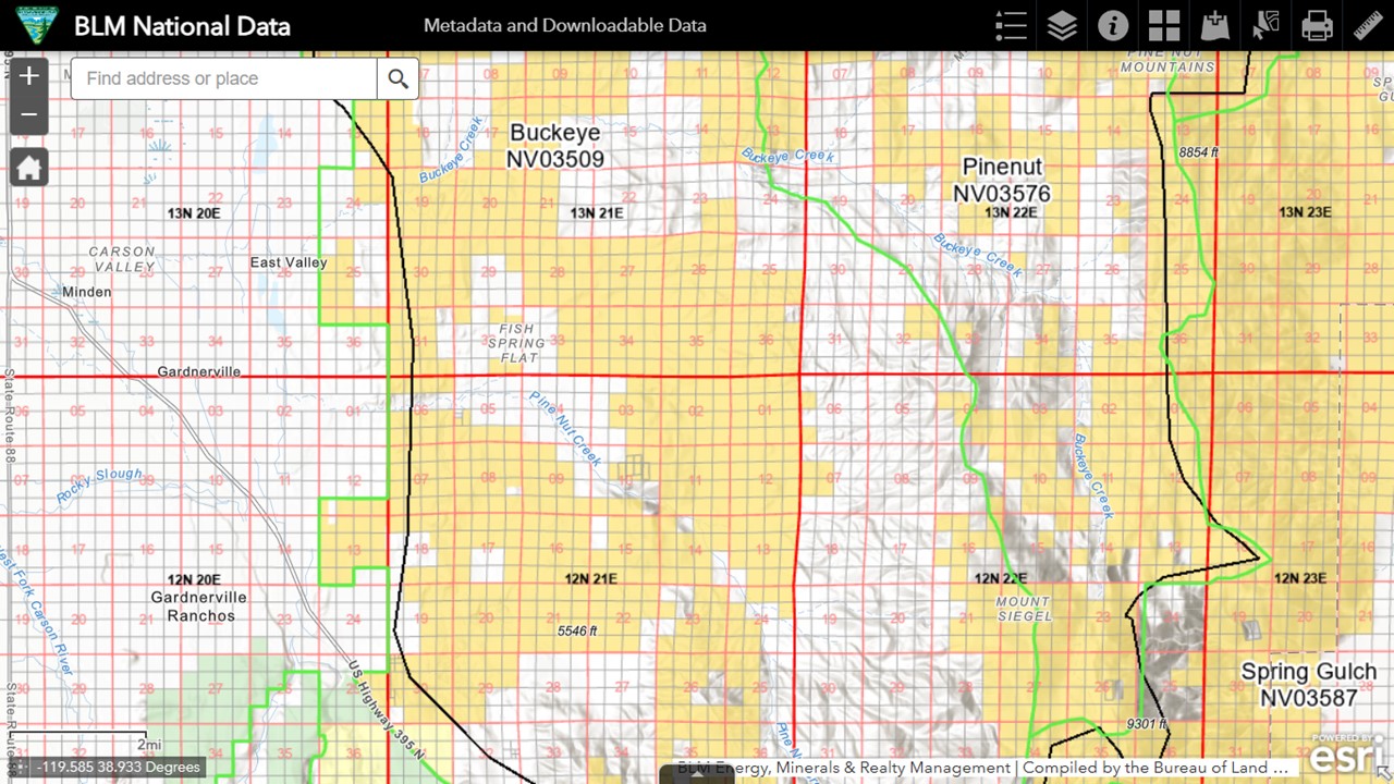
The map shows the Pine Nut Mountains HA, denoted with a black border, and two allotments with green borders.
The Douglas County assessor’s office provides a map for each parcel, which helps you find them on the grid. Click on image to open in new tab.

All of the acreage falls within the HA, which has an AML of zero and is managed principally for livestock.
A small herd lives in the area, to the chagrin of the BLM, but the Pine Nut advocates are driving the numbers down with their favorite pesticide, referred to by CAAWH as the Montana Solution.
Buckeye Creek runs through APNs 1321-00-001-024, 1322-00-001-034, 1322-00-002-005, 1322-00-002-067 and 1222-00-001-061, so they may qualify as a riparian zone.
Given that they’re in an area where livestock are welcomed but horses are not, who will benefit from conservation efforts?
RELATED: CAAWH Spends $3.6 Million on Fish Springs Land Grab.

