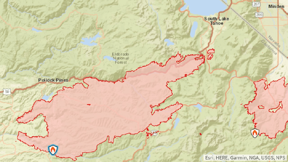
This map from InciWeb shows the location of the fire relative to South Lake Tahoe and the Nevada state line. Spread has mostly been to the east and northeast.
A story by Carson Now says a Type 1 incident command is headed to the area.
The Tamarack Fire, still burning, is 82% contained.
The Pine Nut Mountains HA, which includes the HMA, is off the map, just a few miles east of Minden, NV.
RELATED: Caldor Fire Closing in on Tahoe.
